Hum Hill And The Millennium Cross
Hum is the hill that stands directly above the west side of Mostar in Herzegovina, crowned by the Millennium Cross, and its slopes give one of the widest views over the city, the Neretva river and the Herzegovina hills beyond.
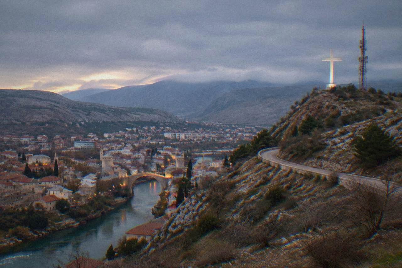
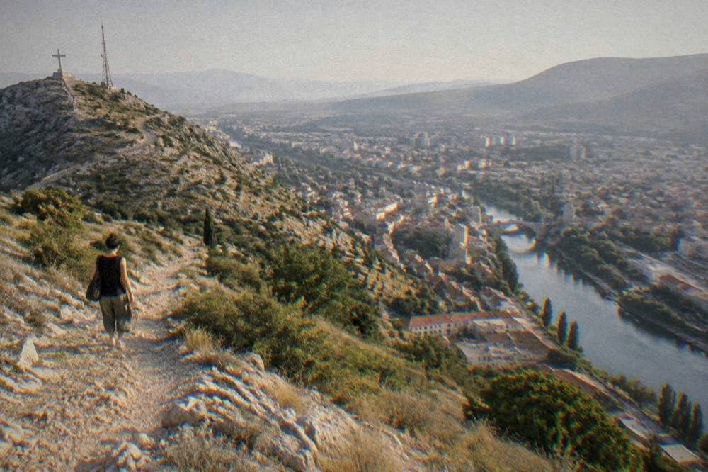
Hum hill rises above western Mostar and is topped by the Millennium Cross. There is no ticket office or staffed entrance: the hillside is open ground, the climb is steep, and the reward is a panorama over Stari Most, the Neretva and the whole city basin.
Hum is the hill that rises immediately above the western side of Mostar, the main city of Herzegovina in Bosnia and Herzegovina, an inland city on the Neretva river with no sea coast. Its summit ridge carries the Millennium Cross, a structure visible from almost every street in the city basin and, on clear evenings, from roads far outside town. Unlike the Old Bridge Area of the Old City of Mostar, the UNESCO World Heritage property inscribed in 2005 that draws the crowds down by the river, Hum has no ticket, no queue and no shop: it is open hillside, and the effort of the climb is the only price. This guide sets out what the hill is, how the routes up work, what you can see from the top, and how to fit it into a wider stay in the city, alongside pages such as things to do in Mostar and the Old Town area guide.
What Is Hum Hill In Mostar?
Hum is the hill that stands directly over the west bank of Mostar, and its summit is marked by the Millennium Cross, a structure that serves as both a landmark and a memorial, visible from across the city and from the Neretva valley below. There is no entrance fee, no staffed gate and no published opening hours: the hillside is open ground on the edge of a living city, reached on foot from the streets below.
The hill functions as Mostar's natural backdrop. Stand anywhere on the west side, from Spanish Square down toward the river, and the cross above the ridge line orients you instantly: it sits uphill of the city, opposite the Fortica ridge that rises on the other side of the Neretva basin. The two high points bracket the city, and together they explain Mostar's shape, a compact grid squeezed into a valley with steep limestone walls on either side.
The name of the city itself is older than any of the modern structures on the hill. The first written mention of the name Mostar dates to 1474, and the name comes from "mostari", the bridge keepers who guarded the earlier wooden crossing over the Neretva. The stone bridge that made the city famous, Stari Most, was completed in 1566, destroyed on 9 November 1993 during the war, and rebuilt and reopened in July 2004. The UNESCO inscription of the Old Bridge Area followed in 2005. The Millennium Cross belongs to a much more recent chapter of the city's story, and like everything from that period, this page treats it with dates and physical facts only.
For planning purposes, think of Hum as three things at once: a viewpoint, a piece of everyday geography for locals who walk its paths, and a serious climbing venue on its rock faces, covered further down this page. Locals treat the slope as an extension of the city, and on any fine evening the paths carry dog walkers, runners and teenagers heading up to watch the lights come on below, which is worth knowing both for company and for the fact that the route never feels remote even after sunset. That everyday use also keeps the main paths worn and findable, so route finding on the standard line is straightforward in daylight.

How Do You Get To Hum Hill From Mostar?
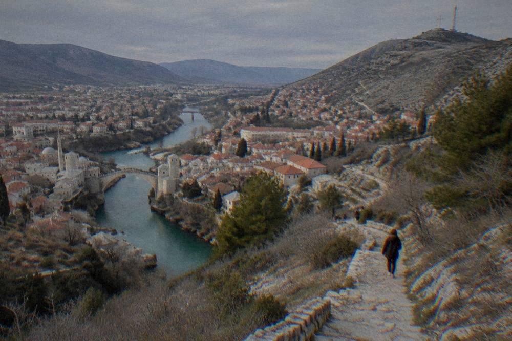
The climb starts from the streets of west Mostar itself: there is no bus, no cable car and no official trailhead car park, so access is on foot from the city, beginning at the residential streets at the foot of the slope. The hill sits directly above the west bank of the Neretva, so the walk begins within the built-up area and continues onto unpaved hill paths. No ticket or booking is needed for the hill itself.
In practical terms, visitors base themselves in or near the Old Town and walk west and uphill. The route passes through ordinary neighbourhoods before the paved streets give way to tracks, and the final stretch is steep, rough and exposed to sun. Footwear matters more than fitness: the paths are dry limestone and loose stone in places, and the FHMZ station table for Mostar records a mean July temperature of 24.7 C with an absolute maximum of 41.2 C, which tells you what midday on an unshaded slope can feel like.
Orientation is simple because the cross is visible from almost everywhere in the city: aim for it. Coming down is harder on the knees than going up, and the light fades quickly behind the ridge in the late afternoon, which is why the timing advice later in this page matters.
For scale, the computed road distances from Stari Most to the other landmarks people usually combine with a city stay look like this:
| Place | Road km from Stari Most | Free-flow minutes |
|---|---|---|
| Mostar airport | 8.2 | 12 |
| Blagaj Tekke | 13.7 | 19 |
| Počitelj | 30.0 | 31 |
| Međugorje (St James church) | 28.3 | 40 |
| Kravica waterfall | 55.2 | 54 |
| Konjic | 69.0 | 80 |
Hum itself is not a drive-to destination: the point of it is the walk from town. If you are staying outside the centre and want a guided introduction to the city before you climb, the private option this site features is the Best of Mostar private walking tour, and you can Check availability on the operator's live listing.
What Can You See From The Top Of Hum Hill In Mostar?
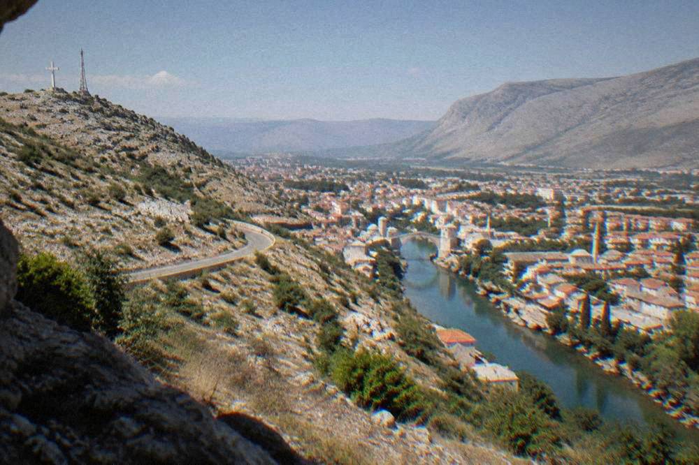
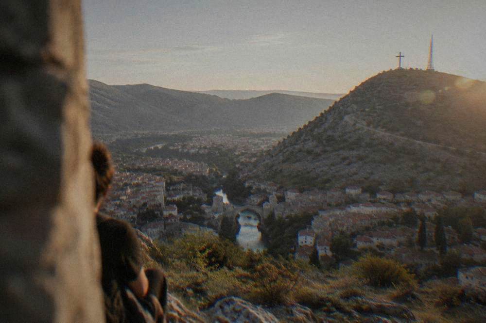
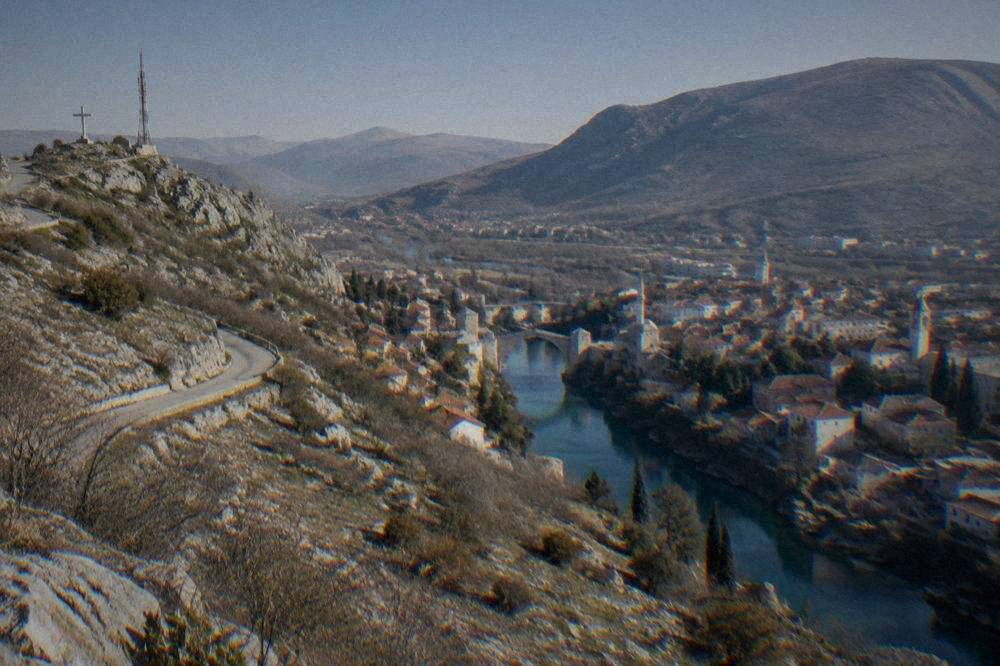
From the summit ridge you look down on the whole of the Mostar basin: the Neretva river threading through the city, the towers and minarets of the Old Town including the dome and minaret of Koski Mehmed-pašina džamija, the rebuilt arch of Stari Most, the boulevards of the west side and the limestone hills that enclose everything. On clear days the view stretches across Herzegovina toward Blagaj and the hills beyond the valley.
The panorama is the reason people climb. Directly below, the city reads like a map: the Old Bridge and the Kujundžiluk bazaar sit in the protected UNESCO core by the river, while the grid of the modern city spreads north and west. Look east and you pick out the ridge of Fortica, the hill on the far side of the valley that carries its own viewpoint and zip line, described in the Fortica attraction guide. Look south and the Neretva carries your eye toward Blagaj, where the Buna spring emerges at the foot of the cliff, about 13.7 km and 19 free-flow minutes by road from Stari Most.
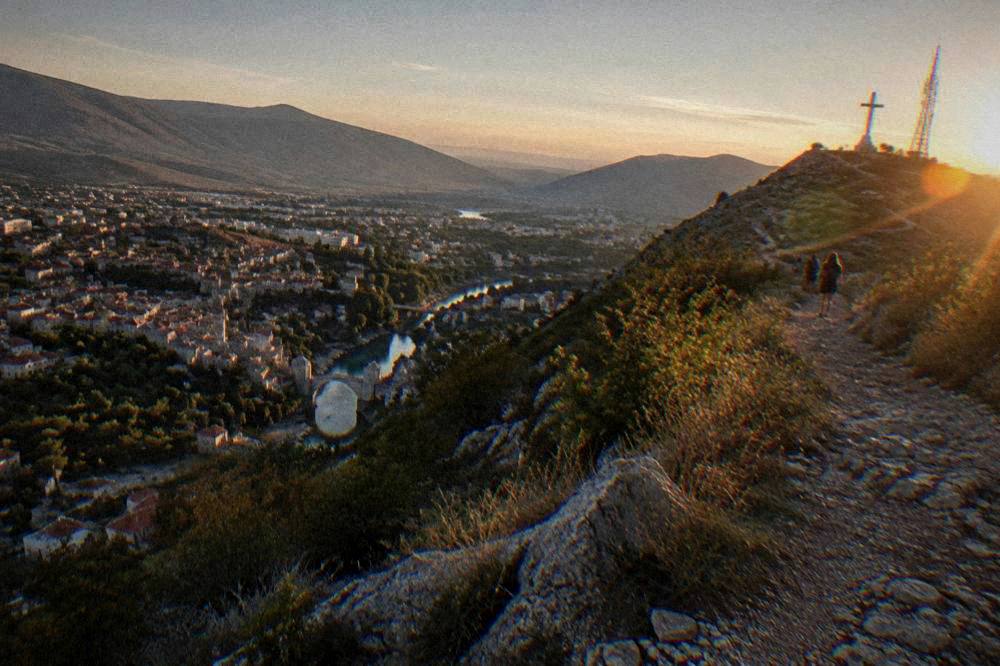
Photographers should note two things. First, the afternoon and evening light comes from behind you as you face the city, which lifts the rooftops and the river. Second, the cross itself is lit after dark, and the view down onto a lit city from beside a lit monument is a different photograph entirely from the daytime panorama, so some walkers go up twice.
Is Climbing Hum Hill Difficult?
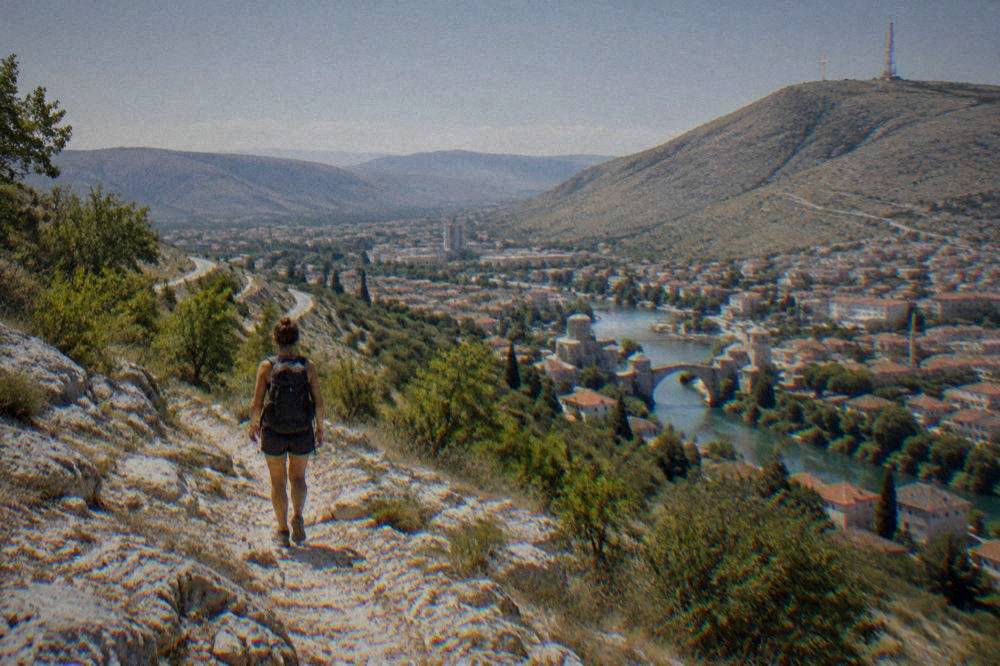
The climb is short in distance but steep and unshaded, and it is harder than the postcard view suggests: the paths rise quickly from the city streets onto dry limestone track with loose stone, there is no water, no shade and no facilities on the slope, and the difficulty comes from gradient and heat rather than technical ground. Ordinary walking shoes and an early start are enough for the standard route.
The key preparation points are heat, water and footwear. The FHMZ Mostar station table, 1961 to 1990, records a mean July temperature of 24.7 C and an absolute maximum of 41.2 C, and the ERA5 reanalysis, 1991 to 2020, gives modelled mean daily highs of 29.9 C in July and 30.5 C in August. Those two figures together describe a valley that gets seriously hot in summer, and an unshaded limestone slope gets hotter still. Carry more water than feels reasonable.
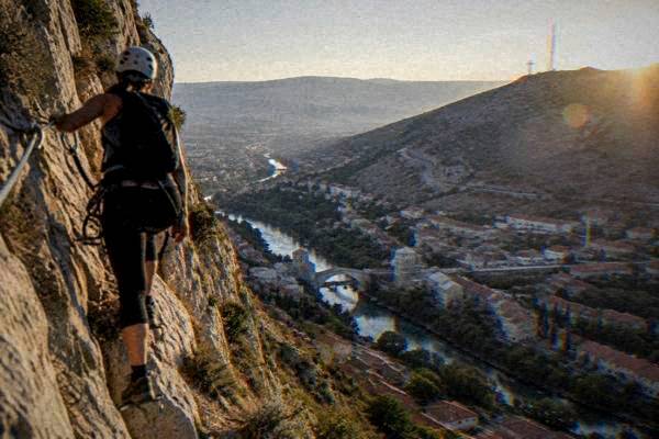
The rock faces of Hum are also a climbing venue, and for that there is a structured option rather than improvisation. A guided via ferrata experience on Hum exists on this site's roster, covering the equipped route with a guide and equipment:
For the ordinary walking route, no guide and no equipment are needed, only sensible pacing. The one safety note that applies across rural Herzegovina also applies to any wandering off the path: stay on marked paths, because suspected mine areas remain in parts of the countryside, and the BHMAC authority maintains the data on suspected areas. The city itself and the main hill paths are normal, busy ground.
When Is The Best Time Of Year To Climb Hum Hill In Mostar?
The shoulder months are the comfortable ones: May, June, September and October combine modelled daily highs with long daylight, while July and August are the hardest because ERA5 reanalysis, 1991 to 2020, puts mean daily highs at 29.9 C and 30.5 C and the FHMZ station table records an absolute maximum of 41.2 C in July. Winter is possible and often clear, but January modelled lows sit at 0.2 C.
The climate tables tell the story better than adjectives. Here are the modelled monthly normals for Mostar:
| Month | Mean daily high C | Mean daily low C | Rain mm |
|---|---|---|---|
| Jan | 8.4 | 0.2 | 142.8 |
| Feb | 9.7 | 0.3 | 143.5 |
| Mar | 13.4 | 3.3 | 142.9 |
| Apr | 17.7 | 7.0 | 150.9 |
| May | 22.3 | 11.4 | 116.1 |
| Jun | 26.8 | 15.3 | 72.4 |
| Jul | 29.9 | 17.7 | 45.4 |
| Aug | 30.5 | 18.1 | 52.6 |
| Sep | 24.5 | 14.0 | 142.0 |
| Oct | 19.5 | 9.8 | 186.8 |
| Nov | 14.1 | 5.7 | 235.8 |
| Dec | 9.3 | 1.4 | 200.0 |
And here is the station record for rainfall and temperature extremes, FHMZ Mostar station, 1961 to 1990:
| Month | Mean temp C | Absolute max C | Absolute min C | Precipitation mm |
|---|---|---|---|---|
| Jan | 4.8 | 18.2 | -10.9 | 164.7 |
| Apr | 13.3 | 30.8 | 0.4 | 127.3 |
| Jul | 24.7 | 41.2 | 8.4 | 42.9 |
| Oct | 15.3 | 32.5 | -0.1 | 150.6 |
| Nov | 10.1 | 23.8 | -4.8 | 200.0 |
Two patterns matter for a hill walk. November averages 200.0 mm of rain against July's 42.9 mm, so late autumn is the season for slippery rock and closed views. And summer heat is real, not rumour: the July absolute maximum of 41.2 C in the station record is a valley-floor figure, and an unshaded slope above the city will not be cooler. If summer is when you are in Mostar, climb at dawn, be down before midday, and spend the afternoon under cover in the Old Town.
One more timing consideration sits outside the weather tables: the summer events calendar. Mostarsko ljeto ran from 25 June to 7 August in 2026, the Mostar Blues and Rock Festival ran on 24 and 25 July, and the traditional Old Bridge diving competition held its 460th edition on 26 July 2026, with the Red Bull Cliff Diving round following from 30 July to 1 August. Around those weeks the riverside and the viewpoints carry noticeably bigger evening crowds, which is either a reason to time your visit or a reason to climb at dawn and have the ridge to yourself. The full index of guides sits on Mostar Travel Guide.
How Does Hum Hill Compare With Fortica As A Mostar Viewpoint?
Hum and Fortica sit on opposite sides of the Mostar basin and give complementary views rather than competing ones: Hum looks east across the whole city from the west, with the cross above you, while Fortica on the east side looks back west across the rooftops toward Hum itself and carries the developed viewpoint infrastructure, including the Skywalk. Both are reached from the city on foot or by road, and neither requires a ticket for the hillside itself.
The honest answer for a short visit is that Fortica is the engineered experience and Hum is the raw one. Fortica has the zip line, the Skywalk and the structured viewpoints; Hum has a cross, a path and silence. Photographers who want the cross in the frame must be on Hum or somewhere facing it, and the classic shot of the cross above the city is taken from the river bridges below, not from Fortica at all.
What Else To Do Near Hum Hill In Mostar?
A morning on Hum pairs naturally with a day in the city below: the descent lands you in west Mostar within easy walking distance of Spanish Square, the Museum of Herzegovina, the Bruce Lee statue and the river banks, and the Old Town core with Stari Most, the Crooked Bridge and the Ottoman houses is a short walk further. Add Bišćević House or Muslibegović House for an hour of shade, and the day writes itself.
A sample day built around the climb:
| Time | Activity | Cost basis |
|---|---|---|
| Early morning | Climb Hum from west Mostar, sunrise over the basin | Free, open hillside |
| Mid morning | Descend, coffee around Spanish Square | Free to wander |
| Midday | Ottoman houses: Bišćević House or Muslibegović House | Small cash fees, about 4 KM and about 8 KM reported |
| Afternoon | Old Town, Stari Most, Kujundžiluk, the Old Bridge Museum | Bridge crossing free; museum about 10 KM reported |
| Evening | View of the lit cross from the river bank | Free |
The sites below the hill are covered in depth on their own pages: the Old Bridge, the Crooked Bridge, Spanish Square and the hill's east-side counterpart, the Fortica guide. For the wider region, the computed distances in the table above show how close Blagaj, Počitelj and Kravica waterfall sit to the city you just climbed above, and day tours from Mostar cover that triangle in a single loop. Kravica is 55.2 km and about 54 minutes by road from Stari Most, and its park page lists entry at 20 KM for an adult all year, with hours that stretch to 22:00 in the June to September window, so a hill climb in the morning and an afternoon at the falls is a realistic pairing in the warm months.
For travellers who prefer a guide for the city portion of the day, the walking options this site features are below:
What Should You Bring For The Hum Hill Walk In Mostar?
Bring more water than the distance suggests, closed shoes with grip, sun protection and a headlamp if there is any chance of descending after dark: the hill has no water point, no shade, no shop and no lighting on the paths, and the descent in fading light over loose limestone is the part that catches people out. A light layer helps in winter, when modelled January lows sit at 0.2 C.
The rest of the kit list is ordinary hill-walking sense. A phone with offline maps works fine for the route, since the city below is always visible and the cross is the anchor. In the hot months, a start at or before sunrise turns the same walk from an ordeal into the best hour of the trip, and the sunrise panorama over the Neretva valley is the reward.
One note on money for the wider day: the currency of Bosnia and Herzegovina is the convertible mark (KM, BAM), pegged at 1 EUR = 1.95583 KM. Euro cash is often accepted in tourist areas at a rounded rate, so confirm before paying, and carry some KM for the small cash fees at the houses and museums listed in the table above. Cards are fine at hotels and larger restaurants, but the small vendors and ticket desks in and around the Old Town still work on cash, so a bank machine withdrawal in KM, choosing to be charged in KM, is the practical move before you set off uphill.
Common Questions About Hum Hill In Mostar
Is Hum Hill free to visit in Mostar?
Yes. The hillside is open ground with no ticket, no gate and no staffed hours. What you spend is effort, water and shoe rubber, not money.
How hard is the walk up Hum Hill?
It is steep, dry and unshaded but not technical. Ordinary walking shoes, an early start in the warm months and plenty of water cover it. The equipped via ferrata route on the rock faces is a separate, guided activity.
Can you see Stari Most from Hum Hill?
Yes. The whole of the Mostar basin is visible from the upper slopes, including Stari Most, the Old Town minarets and the Neretva running through the city, with the Fortica ridge opposite.
When is the best time to climb Hum Hill?
May, June, September and October for comfortable temperatures. In July and August, when ERA5 reanalysis, 1991 to 2020, puts modelled mean daily highs at 29.9 C and 30.5 C, climb at dawn and descend before midday.
Is Hum Hill safe?
The main paths above the city are normal walking ground. Stay on marked paths if you range into the countryside, as suspected mine areas remain in parts of rural Herzegovina. The emergency number in Bosnia and Herzegovina is 112.
How does Hum Hill compare with Fortica?
They sit on opposite sides of the valley. Hum gives the raw hillside, the Millennium Cross and a panorama over the whole city from the west; Fortica carries the developed viewpoint, the Skywalk and the zip line on the east side.