Blidinje Nature Park: Lake, Stećci And Mountain Pasture
Blidinje Nature Park sits on a high karst plateau in the Dinaric Alps above the Neretva valley, a day trip from Mostar through Jablanica that swaps Herzegovina's summer heat for mountain pasture, a shallow lake and fields of medieval stećci tombstones.
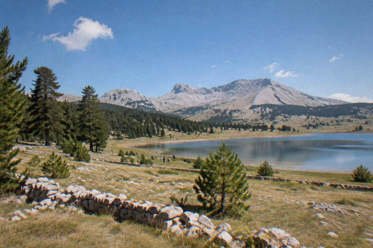
Blidinje Nature Park is a high mountain plateau north of Mostar, reached by road through Jablanica, about an hour's drive from the city. The park holds Blidinje lake, the Dugo polje fields with medieval stećci tombstones, and hiking terrain between the Vran and Čvrsnica massifs. There is no train and no airport: the trip is by car, by tour or by bus as far as Jablanica.
Blidinje Nature Park is the high country that rises directly behind Mostar's side of the Neretva valley, a plateau of mountain pasture, dry stone walls and pine forest that Herzegovina keeps above its July heat. Day trippers reach it by road through Jablanica, the same town that anchors the Neretva rafting and kayak runs further downstream, and the change is abrupt: the road climbs out of the hot valley floor into air that asks for a jacket after sunset. This guide lays out what the park holds, how the drive from Mostar works, what the lake and the Dugo polje stećci fields are, and how to fit Blidinje into a Herzegovina itinerary that otherwise runs through Blagaj, Počitelj and Kravica waterfall.
What Is Blidinje Nature Park And Where Does It Sit Relative To Mostar?
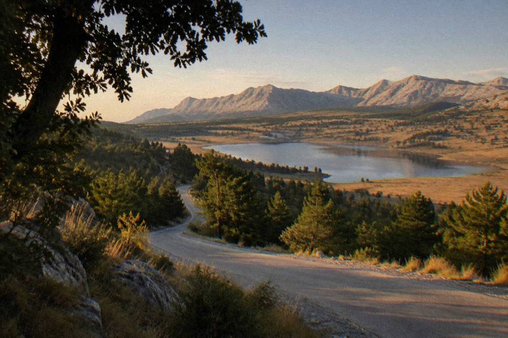
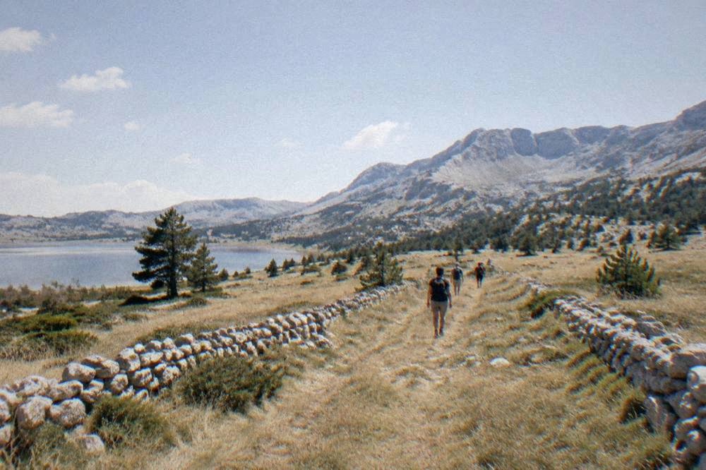
Blidinje Nature Park is a protected mountain park on a high karst plateau in the Dinaric Alps of Herzegovina, lying inland behind the Neretva valley with no sea anywhere near it, roughly north of Mostar in the direction of Jablanica and the high peaks that separate Herzegovina from central Bosnia. The park is named for Blidinje lake, a shallow basin of water held on the plateau, and its landscape is composed of mountain pasture, sinkholes, dry stone walls, endemic pine and the marked hiking terrain of the surrounding massifs. It belongs to the same Herzegovina that Mostar belongs to: inland, mountainous and built on limestone, not coast.
The park's signature pairing is geological and human at once. The plateau holds the Blidinje lake at its heart, and around it stretch open fields, of which Dugo polje is the celebrated one, dotted with stećci, the carved medieval tombstones that appear across Bosnia and Herzegovina and into neighbouring countries. The same stone-carving tradition produced the Radimlja necropolis near Stolac, which sits on the UNESCO stećci listing of 2016; a visitor who has walked Radimlja will recognise the shapes at Blidinje immediately, scattered here across open pasture rather than gathered in a walled yard.
What Blidinje offers that the Mostar basin cannot is altitude. Mostar sits in one of the deepest, closed-in valleys of the region, and its summers are correspondingly heavy: the FHMZ Mostar station, 1961 to 1990, records a July mean of 24.7 C with an absolute maximum of 41.2 C, and the ERA5 reanalysis, 1991 to 2020, models July daily highs at 29.9 C on the valley grid cell. The plateau above runs distinctly cooler, which is the whole logic of the trip: swim in the Neretva's tributaries or raft the canyon on one day, and walk pine forest in thin mountain air on the next.
For context against the rest of a Herzegovina plan, the computed road distances from Stari Most put the region in scale: Jablanica, the gateway town for the climb to Blidinje, is 47.4 km and about 57 minutes of free-flow driving, while Konjic further north is 69.0 km and about 80 minutes. Those two towns bracket the Neretva's upper canyon, and everything Blidinje-related routes through one of them.
| Place on the route north from Stari Most | Road km | Free-flow minutes |
|---|---|---|
| Jablanica (gateway to the Blidinje climb) | 47.4 | 57 |
| Konjic | 69.0 | 80 |
| Boračko jezero (side trip near Konjic) | 89.9 | 113 |
| Sarajevo (Baščaršija) | 127.1 | 134 |
How Do You Get From Mostar To Blidinje Nature Park?
You drive, or you ride a tour vehicle: the practical route from Mostar runs up the Neretva valley to Jablanica, 47.4 km and about 57 minutes free-flow from Stari Most, and then climbs the mountain road onto the plateau, with no train serving the park and no airport within the valley. The drive is the experience in miniature: the road threads the Neretva canyon, passes the destroyed bridge at Jablanica that commemorates the Battle of the Neretva, and then leaves the heat behind in a long, sustained climb through pine to the open ground above.
A rental car gives the fullest day. The valley section is the main road towards Sarajevo, well signed and straightforward, and the mountain section after Jablanica is slower, winding and worth doing in daylight. Free-flow times from the computed table exclude any stops, and they exclude the afternoon when hikers, cyclists and grazing sheep all use the same plateau roads. Fuel up in Jablanica rather than counting on the plateau.
Without a car, the realistic public option is the bus as far as Jablanica and an arranged transfer or a local taxi for the climb; the mountain road is not a casual walking connection, and the plateau's distances between lake, fields and trailheads are driving distances. This is one of the reasons guided day structure appeals here. Among the site's featured options, the trio below covers the two poles of a Herzegovina week, the cold-water river side and the classic southern loop, and a structured day takes the mountain logistics off your plate.
Two practical warnings apply to this drive. Bosnia and Herzegovina uses the convertible mark (KM, BAM), pegged at 1 EUR = 1.95583 KM, not the euro, so any plateau transactions should be planned in marks or confirmed ahead. And rural Herzegovina, including mountain terrain off the marked roads, carries landmine risk in places: the standing advice is to stay on marked paths and roads, which on a plateau criss-crossed by old tracks is not a formality.
The rail line that runs up the same valley is worth knowing for the wider itinerary even though it does not serve Blidinje. Passenger trains between Sarajevo and Čapljina via Mostar, two a day each way, resumed on 15 October 2026 after a suspension that began in early September 2026 following a fire along the corridor, so a car-free traveller can now again pair a Mostar stay with Sarajevo by rail and pick up a Blidinje or Jablanica excursion from the Mostar end.
What Are The Stećci At Dugo Polje And Why Do They Matter?
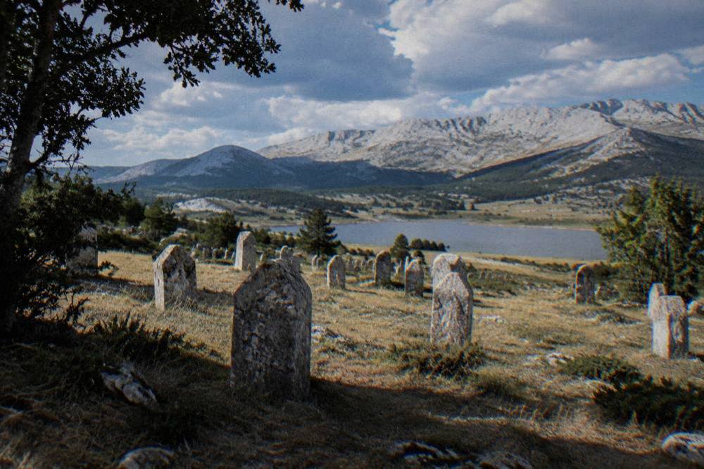
Dugo polje is an open field on the Blidinje plateau holding a scattered necropolis of stećci, the carved medieval stone tombstones found across Bosnia and Herzegovina, the same tombstone tradition that earned the serial UNESCO listing in 2016, of which the Radimlja necropolis near Stolac is the best-known component. The stones lie in the grass among grazing land and dry walls, low chests and standing slabs, some carved with crosses, rosettes, spirals and figures. Where Radimlja reads as a monumental cemetery, Dugo polje reads as a landscape: the tombstones are simply part of the pasture.
The stećci tradition spans the medieval Bosnian and Hum (Herzegovinian) kingdom periods, and its carvings mix symbols that later traditions claimed and disputed: crosses, crescents, hunting scenes, dancers, hands. The UNESCO inscription of 2016 recognised some thirty sites across four countries, and the Radimlja necropolis, 33.5 km and about 42 free-flow minutes from Stari Most on the Stolac side of Herzegovina, is the component printed on guidebook covers. Visiting both gives the full arc: Radimlja for density and finish, Dugo polje for setting.
Practically, the stones on the plateau are unprotected by turnstiles. Treat them as the monuments they are: no climbing, no rubbing, no rearranging. The grassland around them is working pasture, and gates, fences and livestock are part of the visit.
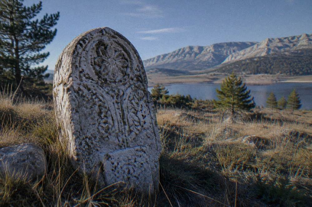
For the wider stećci thread in a Herzegovina itinerary, a short comparison of what each site offers the traveller:
| Stećci site near the Mostar orbit | Character | Setting |
|---|---|---|
| Dugo polje, Blidinje | Scattered stones in open mountain pasture, informal access | High plateau, cool air, hiking country |
| Radimlja, near Stolac | Dense, richly carved necropolis, best-known component | Roadside near Stolac, pairs with Počitelj |
| Stećci elsewhere in Herzegovina | Scattered single stones and small groups in villages and fields | Reached on regional drives |
What Is Blidinje Lake Like, And When Is The Best Time To Visit?
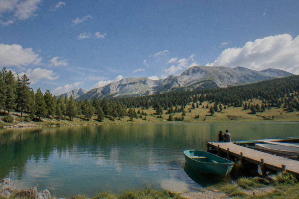
Blidinje lake is a shallow, seasonal karst lake sitting in the basin of the plateau, larger and fuller in the wet months and drawn down by late summer, ringed by pasture and pine rather than beaches, and the park's visitor season runs strongest from late spring through early autumn, when the mountain roads are clear and the plateau is free of snow. The lake is a walk-and-look destination, not a swimming resort: its level moves with the karst water beneath it, and the shoreline is reed, gravel and meadow.
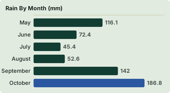
Timing against the Mostar climate record is where the trip earns its place. Mostar's rain is a winter phenomenon: the FHMZ station, 1961 to 1990, records November at 200.0 mm against July's 42.9 mm, roughly four and a half times wetter, while the ERA5 reanalysis, 1991 to 2020, models November at 235.8 mm of rain against July's 45.4 mm on the valley grid. Winter rain in the valley is winter snow on the plateau, and the same months that flood the lake also close or degrade the high roads. The sweet spot is the shoulder: June through September combines the valley's driest, most reliable weather with full plateau access, and August is the month when the altitude difference matters most, because the valley grid's August mean daily high models at 30.5 C while the plateau above runs well below it.
| Month (valley grid, ERA5 reanalysis 1991-2020) | Mean daily high | Mean daily low | Rain |
|---|---|---|---|
| May | 22.3 C | 11.4 C | 116.1 mm |
| June | 26.8 C | 15.3 C | 72.4 mm |
| July | 29.9 C | 17.7 C | 45.4 mm |
| August | 30.5 C | 18.1 C | 52.6 mm |
| September | 24.5 C | 14.0 C | 142.0 mm |
| October | 19.5 C | 9.8 C | 186.8 mm |
Read that table as the valley floor, and subtract for altitude. A September day that models at 24.5 C in Mostar can end in a cold wind on the plateau by evening, so layers, sun protection and real shoes are the packing list, in that order. Snow lingers on the high ground well after the valley has warmed, and in deep winter the park becomes a snowshoe and ski-country destination rather than a day trip; if a winter visit is on your plan, treat road conditions as the deciding factor and confirm locally before committing the day.
What Can You Actually Do In Blidinje Nature Park In One Day?
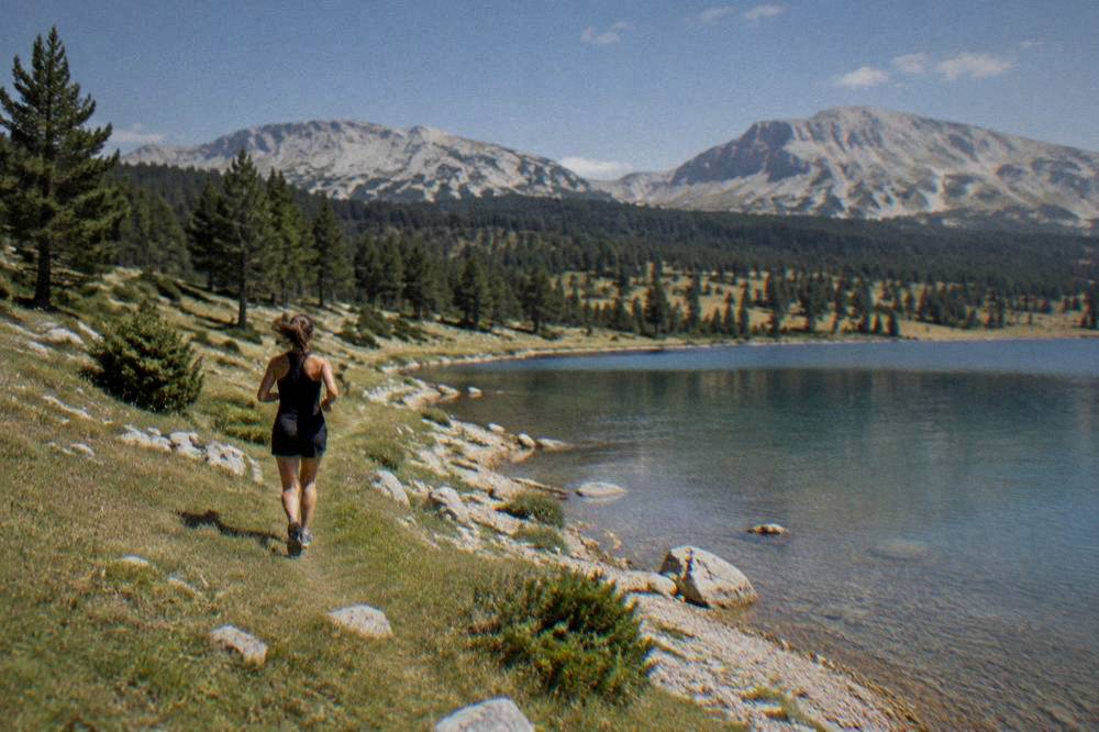
A full day in Blidinje divides naturally into four moves: drive the plateau road that links lake, pine forest and the high pasture, stop at Dugo polje to walk among the stećci, take one marked hike on foot toward the surrounding peaks or ridges, and finish with a slow meal of Herzegovinian mountain food before the descent back to the valley. None of the four requires technical skill; all four require daylight, because the mountain road after dark is a different proposition than the valley highway.
Hiking is the park's core activity. The terrain between the Vran and Čvrsnica massifs offers walks from short pasture loops to real summit days, and the same rule that applies across rural Herzegovina applies doubly here: stay on marked paths and roads, both for safety and because off-path ground in the wider region carries landmine risk in suspect areas. The park's trail marking is the authority to follow on the ground; a map at the local information points or a guide settles the rest. For walkers comparing options, the highland village walk of Lukomir on the other side of the Bjelašnica range makes a natural sister trip, and the lowland walking counterpart from Mostar is a classic city walk such as the Mostar walking tour.
Cycling and road touring suit the plateau well, since the topography rewards steady riding between long views. Birdwatchers and botanists find the karst flora and the open sky the point; photographers find the stone walls and the tombstones in the grass. And in the cold half of the year the park flips to winter sports, which is the local use of the same roads and lifts of the massif. Other pages covering the same trip are gathered on Mostar Travel Guide.
Food is not a footnote here. The Herzegovinian mountain table runs on lamb and potato cooked slowly, fresh cheese, flatbread baked under a metal lid in embers, and the syrupy desserts of the region; a long lunch on the plateau is half the reason Mostar residents make the trip themselves. Pair it with the pages on Bosnian food planning if a food-first itinerary is the goal.
Can You Combine Blidinje With Jablanica, Boračko Jezero Or Konjic?
Yes, and the combination is the efficient way to spend the fuel: Jablanica sits on the valley road 47.4 km and about 57 minutes from Stari Most and is the unavoidable gateway to the plateau, Boračko jezero lies further north near Konjic at 89.9 km and about 113 free-flow minutes, and a one-loop day can take in Blidinje, a Jablanica stop and still return to Mostar inside a long daylight window in summer. The reverse order also works: Blidinje first in the cool morning, the valley stops on the way down.
Jablanica anchors the valley leg twice over. It is the access point for the climb, and it holds the riverside sites of the Battle of the Neretva story, including the destroyed bridge on the Neretva that remains in the river as a monument to the wartime operation, and the Museum Battle for the Wounded on the Neretva, whose printed prices have varied between lists; the museum's own page has carried inconsistent figures, so expect a few marks and confirm at the desk. The fuller history is covered in the site's Jablanica day trip guide.
Boračko jezero, a mountain lake in its own right east of the Neretva canyon, is the swimmer's alternative to Blidinje's karst basin, and it slots into the northern variant of the loop. Konjic, 69.0 km out, adds the old wood-carving town and the ARK D-0 atomic-era bunker, which requires advance booking for its guided tours; the site's Konjic page carries the details. Trying to force all of Konjic, Boračko jezero and Blidinje into one day is possible in midsummer daylight but rushed; two of the three is the honest formula.
| Combination day from Mostar | Feasible in a day | The trade-off |
|---|---|---|
| Blidinje + Jablanica bridge and museum | Comfortable | The standard loop |
| Blidinje + Boračko jezero | Comfortable in summer | Longest driving, two lakes |
| Blidinje + Konjic (ARK D-0) | Tight | Bunker booking times dictate the day |
| Blidinje + Rama lake | Possible, long | Two plateau lakes, least driving in the valley |
A second lake option, Rama lake, sits west of the Jablanica reach and makes a quieter water-and-mountain pairing for travellers who have already done the classic southern loop through Blagaj and Počitelj.
How Does Blidinje Fit Into A Wider Herzegovina Itinerary?
Blidinje is the mountain day in an itinerary that otherwise runs on stone, water and valley: pair it with the Old Bridge and the Ottoman town in Mostar itself, the Blagaj Tekke at the Buna spring, the fortified village of Počitelj and Kravica waterfall to the south, and the stećci thread that connects Dugo polje with Radimlja near Stolac. Three or four days covers the spine of it, with Blidinje slotted as the altitude and cool-air counterweight, ideally mid-trip when the valley forecast peaks.
The southern cluster is compact and road-fast: Blagaj Tekke is 13.7 km and about 19 minutes from Stari Most, Počitelj 30.0 km and about 31 minutes, Kravica waterfall 55.2 km and about 54 minutes. That cluster is what the classic Herzegovina day tours cover, and it is the natural complement to a Blidinje day, since one day gives you mountain pasture and the next gives you river, cliff and waterfall. The site's planning pages, including the Herzegovina road trip and the Boračko jezero guide, break the sequencing down day by day.
For travellers who like their itinerary thematic rather than geographic, three threads run through the region and all pass through Blidinje's orbit: the stećci thread (Dugo polje, Radimlja), the water thread (Neretva kayaking and rafting, Kravica, Blidinje and Rama lakes) and the heritage thread (Mostar's UNESCO inscribed Old Bridge Area, Počitelj, the Žitomislici monastery). A week in Herzegovina can honestly run all three.
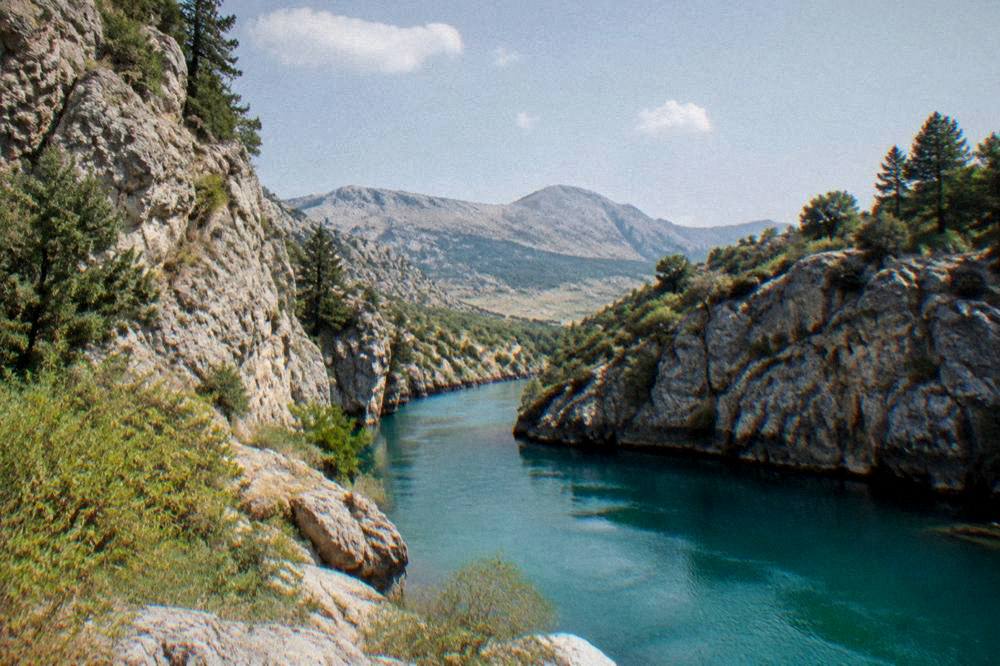
The river thread deserves one specific note. The Neretva that carved the valley beneath Blidinje runs cold even in August, fed by karst sources, and the kayak safari below is the site's featured way onto that water: gear, guide and river in one booking, with no product figures needed here because the live listing carries them.
What Should You Know Before You Go: Money, Borders And Safety?
Bosnia and Herzegovina uses the convertible mark (KM, BAM) pegged at 1 EUR = 1.95583 KM, it is not in the EU and not in Schengen, visa-exempt visitors may stay up to 90 days within six months of first entry, and in rural Herzegovina the standing safety rule is to stay on marked paths because of suspected mine areas. None of that is complicated, but all of it is worth having straight before a mountain day that ends in a village household rather than a city terminal.
Money first. Marks are the currency; euro cash is often accepted in tourist areas at a rounded rate, but that is a courtesy rather than a rule, so confirm the rate before handing over notes. On the plateau, small households and roadside stops are cash country, and cards cannot be assumed. A tourist tax is reported at 3 KM per person per night in the canton from 1 January 2026: treat it as reported and confirm at booking, since accommodation providers handle it differently.
Entry and borders matter mainly to visitors looping Blidinje with Croatia, Dubrovnik most commonly. The BiH-Croatia land border is a Schengen external border with full checks since 1 January 2023, ETIAS is not in operation, and reported waits at the main crossings run up to about 30 minutes, longer at summer peaks. Mostar's own airport has a small route list, Zagreb with Croatia Airlines and Stuttgart with Eurowings among the reported services, so many visitors instead arrive via Sarajevo or Dubrovnik airports.
Safety on the day is simple and worth repeating: stay on marked paths and roads in rural terrain, the emergency number is 112, and mobile coverage on the plateau is patchy between ridges. Weather changes fast at altitude, the sun is strong even when the air is cool, and the descent road in rain deserves respect. None of this is alarming; it is ordinary mountain arithmetic, the same as any Dinaric range.
| Practical item | The rule or figure |
|---|---|
| Currency | Convertible mark (KM, BAM); 1 EUR = 1.95583 KM |
| EU / Schengen status | Bosnia and Herzegovina is in neither |
| Visa-exempt stay | Up to 90 days within six months of first entry |
| Croatian land border | Schengen external border, full checks since 1 January 2023 |
| Reported border waits | Up to about 30 minutes, longer at summer peaks |
| Emergency number | 112 |
| Rural safety rule | Stay on marked paths (suspected mine areas, BHMAC) |
| Tourist tax (reported) | 3 KM per person per night from 1 January 2026, confirm at booking |
The kayaking alternative, for the day the mountains feel like too much logistics, is carded below beside the classic southern day tour, and the private walking option covers the city end of the itinerary.
A private city walk is the right bookend to a Blidinje day, since the plateau deserves an early start and the Old Town deserves a slow evening; the solo option below is that bookend.
For a fuller pairing of the two ends of Herzegovina's vertical range, the southern loop is the standard companion, and it is the one most often booked by travellers who have already walked Mostar's streets.
Common Questions About Blidinje Nature Park From Mostar
How far is Blidinje Nature Park from Mostar?
The route runs through Jablanica, which is 47.4 km and about 57 minutes of free-flow driving from Stari Most, followed by the mountain climb onto the plateau. No train serves the park, so the trip is by car, tour vehicle or bus plus transfer.
Can you swim in Blidinje lake?
Blidinje lake is a shallow karst lake whose level moves with the seasons, ringed by pasture and gravel rather than beaches. Treat it as a walking and landscape destination; for swimming, the Neretva valley and its lakes are the practical options.
Are the stećci at Blidinje part of the UNESCO listing?
The stećci tradition was inscribed on the UNESCO World Heritage list in 2016 as a serial property across several countries, with Radimlja near Stolac as the best-known component. The Dugo polje stones at Blidinje belong to the same carved tombstone tradition scattered across Herzegovina.
When is the best time of year to visit Blidinje?
Late spring through early autumn. The valley's driest months are June through September, with the ERA5 reanalysis, 1991 to 2020, modelling July rain at 45.4 mm against November's 235.8 mm, and winter rain in Mostar is snow on the plateau, which closes or degrades the high roads.
Can you visit Blidinje without a car?
Partly. Buses run up the Neretva valley towards Jablanica, and trains between Sarajevo and Čapljina via Mostar resumed on 15 October 2026, but the climb onto the plateau needs wheels, so a guided day, a transfer or a taxi from Jablanica is the realistic car-free plan.
What should you pack for a Blidinje day trip?
Layers, sun protection and sturdy shoes. Summer valley highs model at around 30 C on the ERA5 1991 to 2020 grid, while the plateau runs well below that and cools fast after sunset, and the terrain is grassland, gravel and pine forest rather than pavement.
Blidinje is the piece of Herzegovina that the postcards of Stari Most leave out, and the plateau repays the hour of driving with the one thing the valley cannot supply in August: cool air under a wide sky. Pair it with the river below, and the region's full vertical range, from Neretva water that stays cold even in summer to pine ridges that hold snow into spring, fits inside a single week based in Mostar.